See
Spatial visualization of assets, customers, branches, tracks, boundaries, policies, and operations.
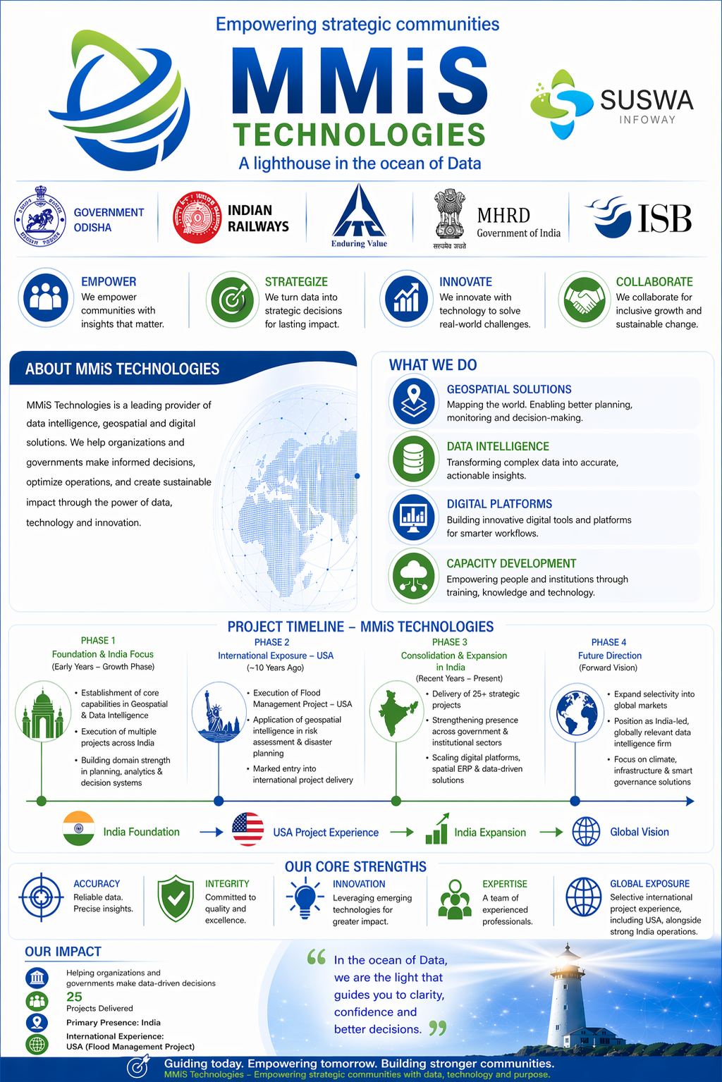
Spatial ERP for strategic intelligence
MMIS Technologies fuses spatial and non-spatial data into Environment Intelligence: a practical command layer for boards, regulators, railways, banks, and government programs.


The Research Position
Traditional MIS and BI systems describe internal performance. MMIS adds the missing external context: geography, policy, compliance, assets, risk, and live operational surroundings. The result is decision intelligence that leaders can see, question, and act on.
The map becomes the value-added format for connecting knowledge, operational events, compliance, and management objectives.
Self-operable decision tools for mapping goals achieved to plans, mission progress, vulnerabilities, and field realities.
Existing ERP, TMS, CBS, Excel, IoT, mobile, and legacy systems can be extended into a unified map-based command layer.
Platform Architecture
Most ERP systems record transactions. MMIS translates operations into geographic intelligence, showing where activities originate, how goals move against plans, and which risks need attention first.
Spatial visualization of assets, customers, branches, tracks, boundaries, policies, and operations.
Integrated analytics across internal MIS, secondary data, risk layers, and environmental context.
Decision-ready dashboards for leadership, regulators, inspectors, and program administrators.
Applied Domains
POC work for grievance monitoring, consumer affairs, and non-life insurance analysis using geography as a regulatory intelligence base.
Insurance POC paperCustomer-base mapping and balance sheet navigation models that reveal branch, market, and product performance spatially.
Banking slidesModels for distribution management, farmer-level productivity analytics, freight policy integration, and receivables visibility.
Fertilizer product paperKnowledge mining and action-plan mapping for state agriculture programs, production planning, and monitoring mechanisms.
Knowledge mining paperMonitoring and management frameworks for Forest Stewardship Certification programs and plantation intelligence.
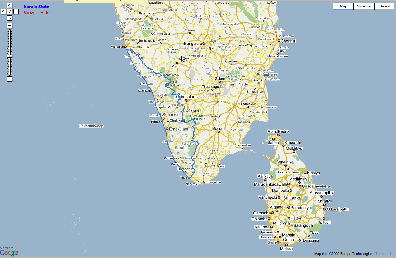
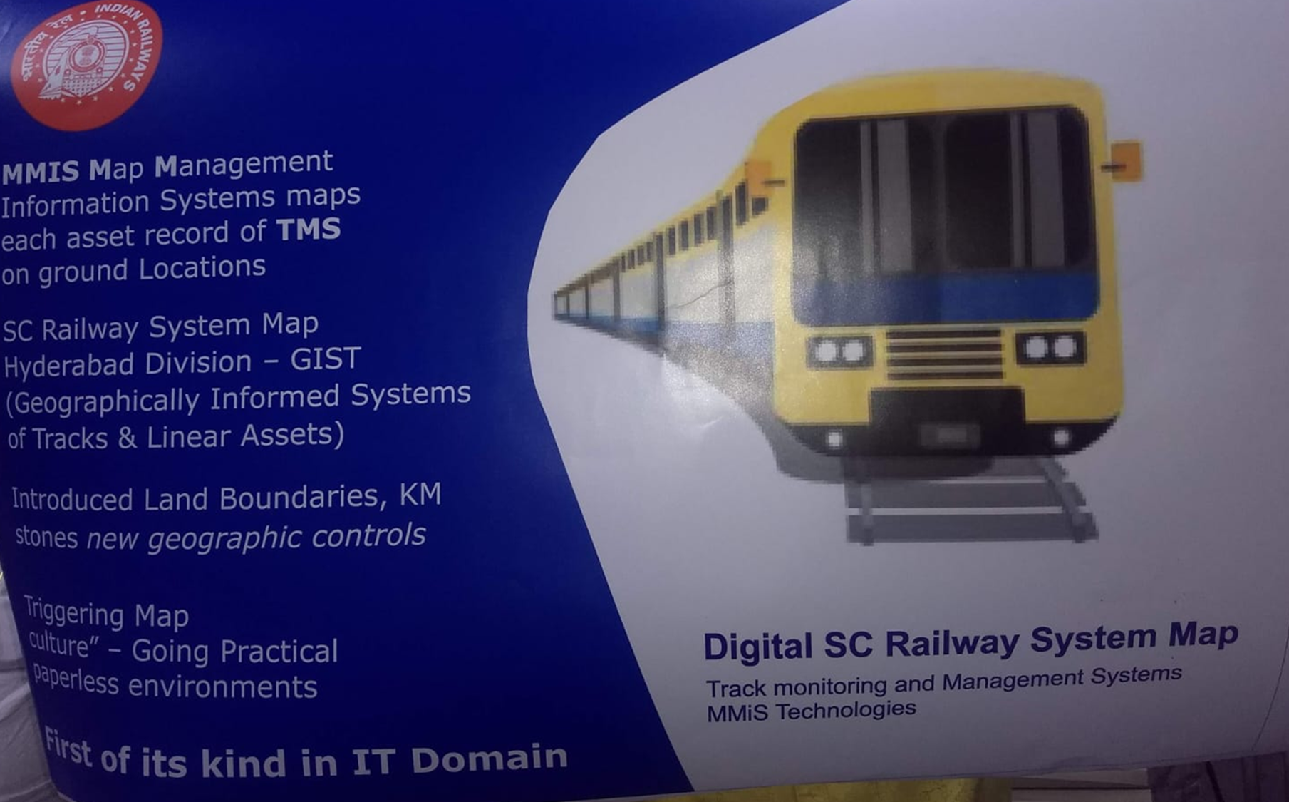
FSC implementation paperPredictive safety monitoring for tracks, bridges, land boundaries, stations, encroachments, and linear assets using Digital Twin concepts.
Explore appsSelected Engagements
Client and program names are grouped here once for clarity. Individual sections focus on domain value rather than repeating the same names.
Digital Safety
New material positions MMIS as a holistic safety intelligence platform: integrating TMS asset records, track and linear assets, rolling stock, encroachments, maintenance history, movement patterns, geospatial mapping, and Digital Twin systems.
Applications and Deployments
Explore deployed systems and proof-of-concept applications. For access, demonstrations, or app walkthroughs, contact MMIS Technologies directly.
Digital Gender Atlas
Education and vulnerability mapping for district-level planning
Request a demo
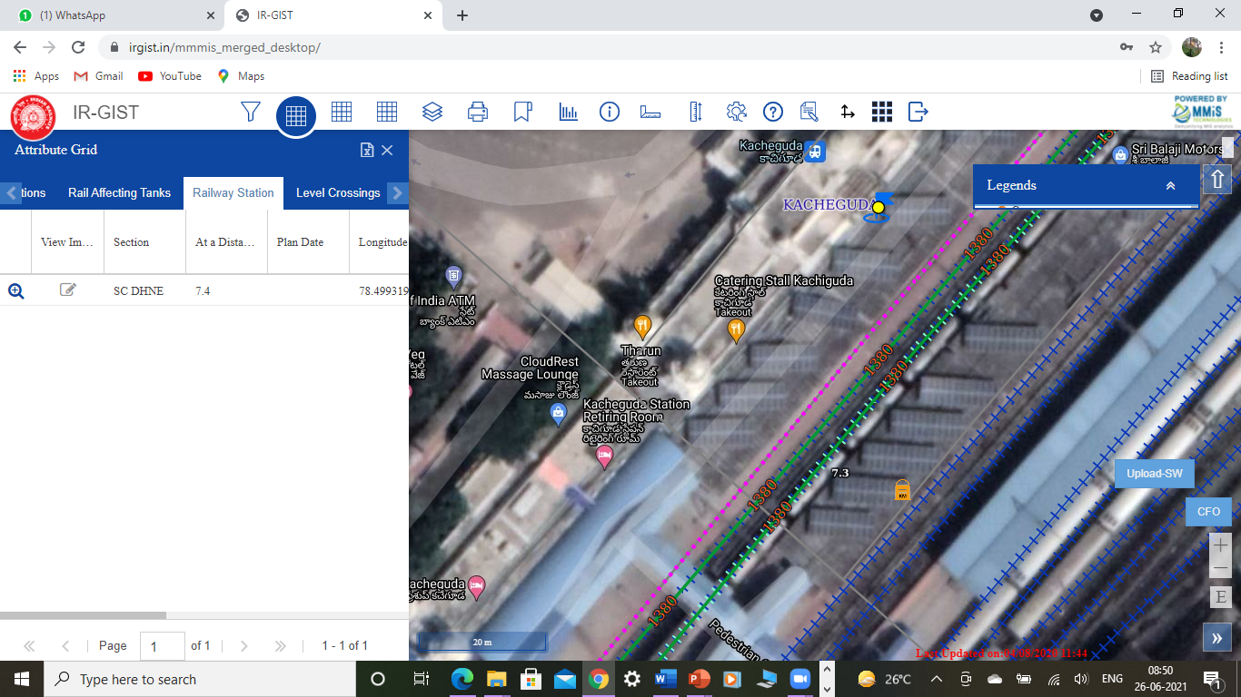
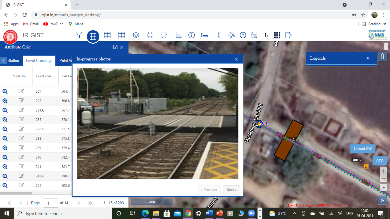
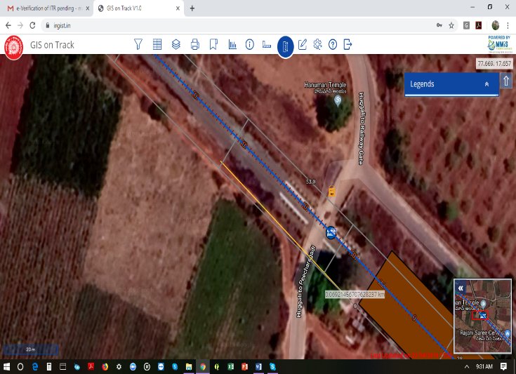
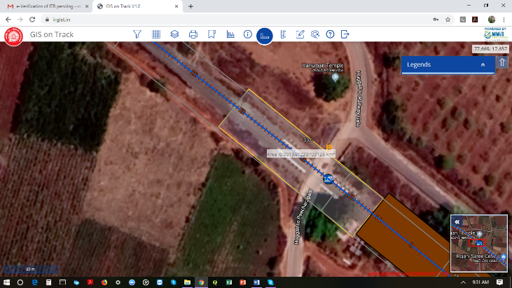
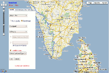
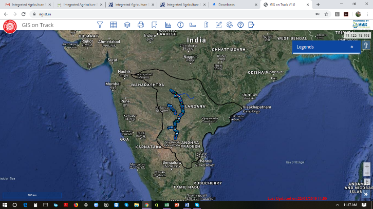
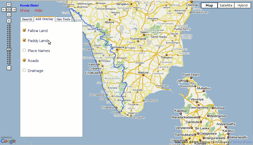
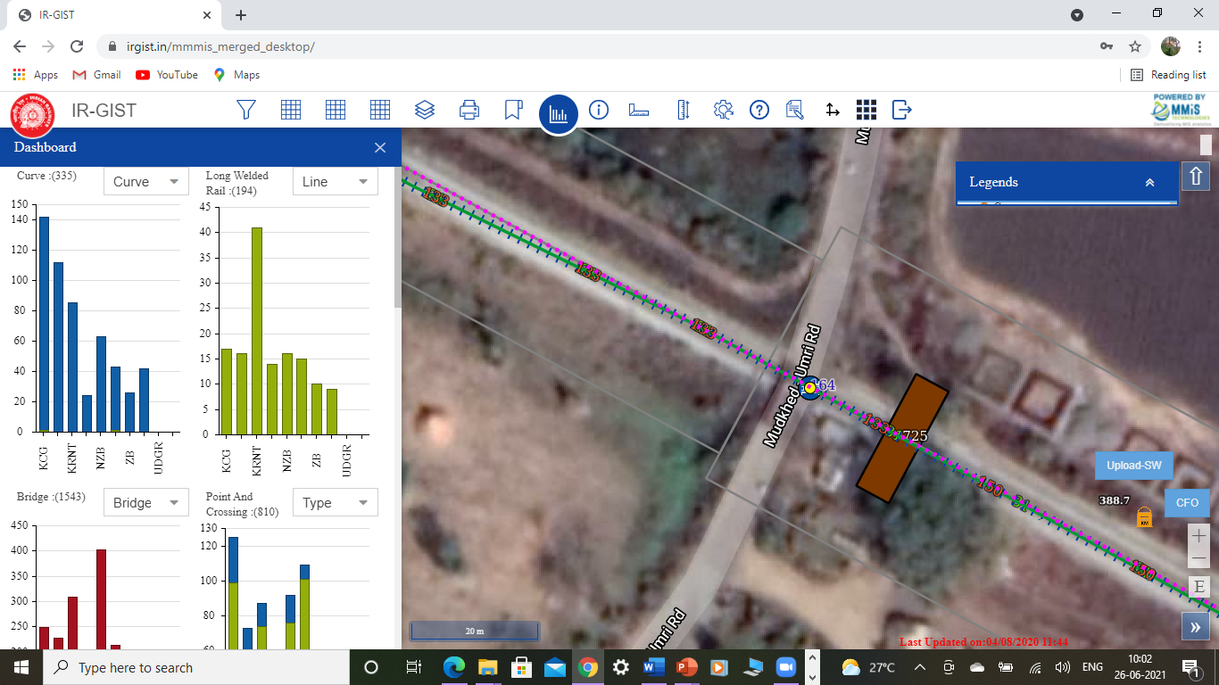 IR-GIST
Digital system map and linear asset intelligence
Discuss access
IR-GIST
Digital system map and linear asset intelligence
Discuss access
 IRDA
Insurance regulatory POC and non-life analysis
Discuss use case
IRDA
Insurance regulatory POC and non-life analysis
Discuss use case
 Flood Automation
Flood automation program
Request walkthrough
Flood Automation
Flood automation program
Request walkthrough
 Census
Administrative data mapping
Request walkthrough
Census
Administrative data mapping
Request walkthrough
 ITC Plantation Program
Forestry and plantation monitoring application support
Discuss the program
ITC Plantation Program
Forestry and plantation monitoring application support
Discuss the program
Validation
The Xlr8 Andhra Pradesh Technology Validation Report evaluated MMIS Technologies and Concepts with strong commercial potential across sectors. IDRBT session feedback also records positive participant ratings for MMIS visual analytics demonstrations.
Recognition and Feedback
These signals are placed as supporting context: they show how MMIS concepts have been received in visual analytics, banking technology, and national program conversations.
Session feedback from 30 participants recorded average scores of 3.7 and 3.8 out of 5 for MMIS Technologies visual analytics demonstrations.
The XLr8AP Technology Validation Report identifies MMIS Technologies and Concepts as a map-based reporting and decision framework with cross-sector commercial potential.
Open validation reportA one-minute reference segment, starting at 14:00, highlighting the Gender Atlas topic noted in the source material.
Watch the 1-minute segmentResearch Library
Selected papers and presentations from the MMIS evidence base, grouped for research review and client discussions.
Research Leadership
MMIS Technologies is a small research and development practice shaped by Ravi Ganesh Mantha's 30 years of IT experience, with specialization in government MIS mapping, solution architecture, and customized spatial decision systems.
The team’s work spans education, insurance, forestry, fertilizer, banking, rural development, and government GIS initiatives, including the Digital Gender Atlas for Advancing Girls Education, which integrated over 7 billion records from multiple sources.
Contact